[guestbook] [about] [printable page]
Welcome to The Trefall Page
|
New Trefall-page
is slowly growing: trefall.com/blog
These pages are dedicated to the place I grew up: the farm Trefall in the valley of Eksingedalen on the west coast of Norway. Main topics: |

|
|
|
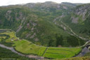
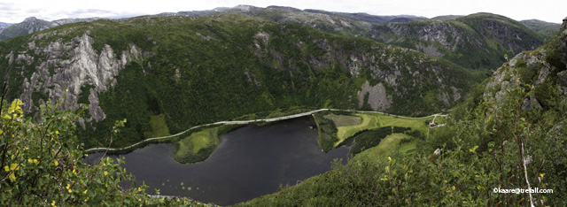
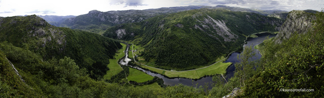
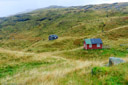
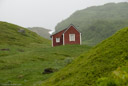
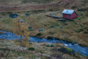
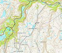
| Trefall is the third uppermost farm in the valley of Eksingedale. It is said that the farm Ekse, the second uppermost, was the first settled. The two bards, Gissur Gullbraa and Bjarne Gullbraaskald, both told about in Snorre Sturlason's saga about King Olaf the Saint (Olav Haraldson), and both present in the battle at Stiklestad in the year 1030, is said to come from the uppermost farm, Gullbraa. Trefall, "the palce trees lays fallen, either by storm or aging", is fist mentioned in written sources in about 1640. The road through the valley was built to Trefall in the 1930s, and was not continued further up the valley until after World War II. Before the road came, most travellers went over the mountain Naerafjellet to Brekkhus in the neighbour valley, and further to Evanger and Voss. Because of this the language spoken by the elder was the old dialect of Voss, today known as "Vossamaol". The electricity came to Trefall in 1955, and the telephone in about the same time. Hourses where used for work on the farm until the end of the 60s. The mountain pasture of Trefall, Trefallstoelen, was used the old way until 1967, as the last in the valley. | |
 (more panorama pictures)
|
|
|
Stories and pictures from Trefall
(click on a picture):
|
|||
| Kari's stories, about the life on the farm Trefall between 1893-1913 |

|

|
Pictures showing how the farm looked like in about the 1950s |
| My Father's stories about the life on the farm Trefall (coming) |

|

|
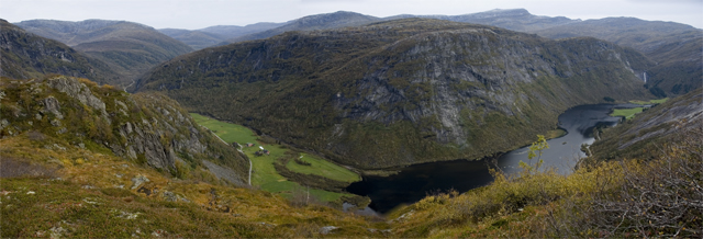
Trefall seen from Geitanesberget and Trefallnovi 2002 |
| Trefall seen from Aasen and Trefallstrada 2002 |

|

|
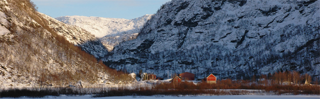
Trefall (mostly bruk #2) 30.10.2005 |
| Autnum at Trefall 2006 |

|

|
Trefall Christmas Eave 2006 |
| The Easter 2008 |
|
|
Trefallsnovi August 2008 |
|
|
|||
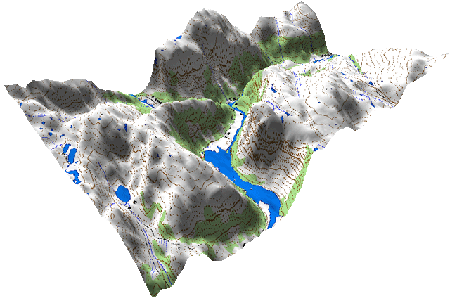
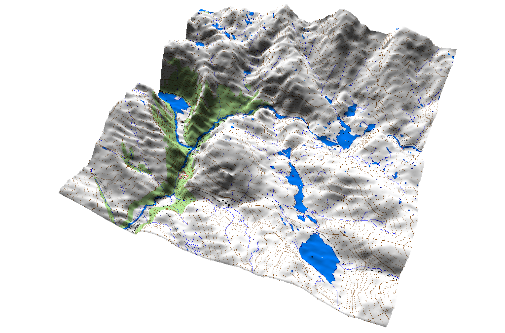
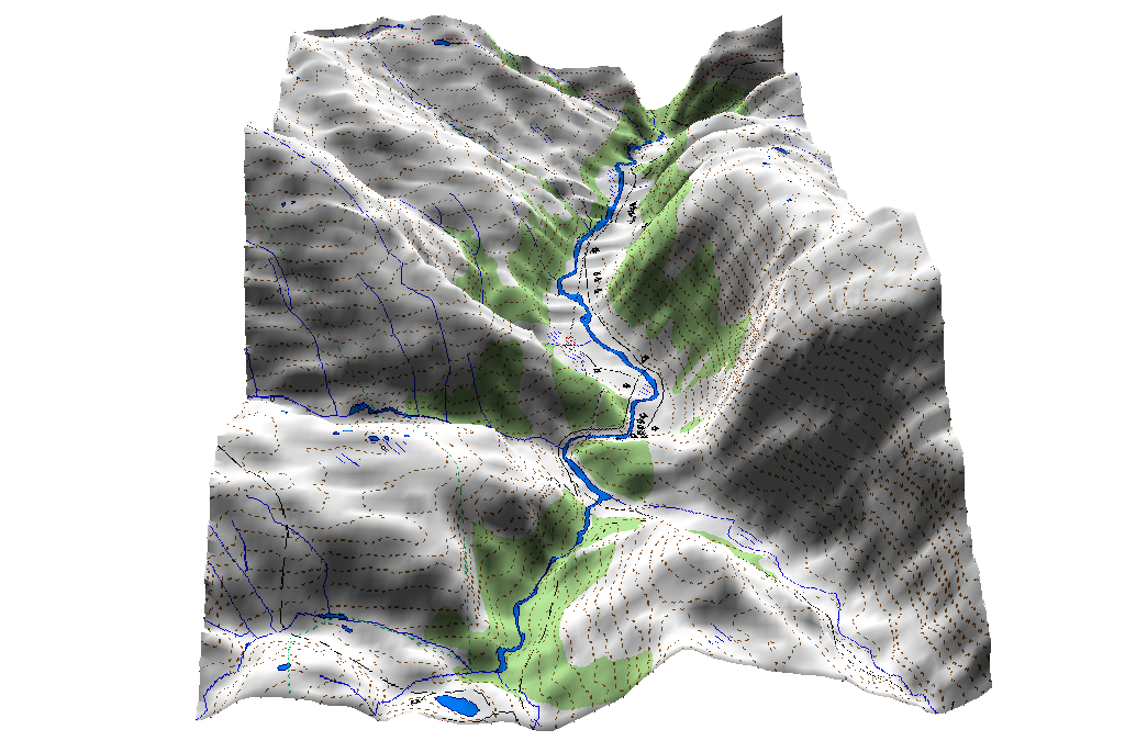
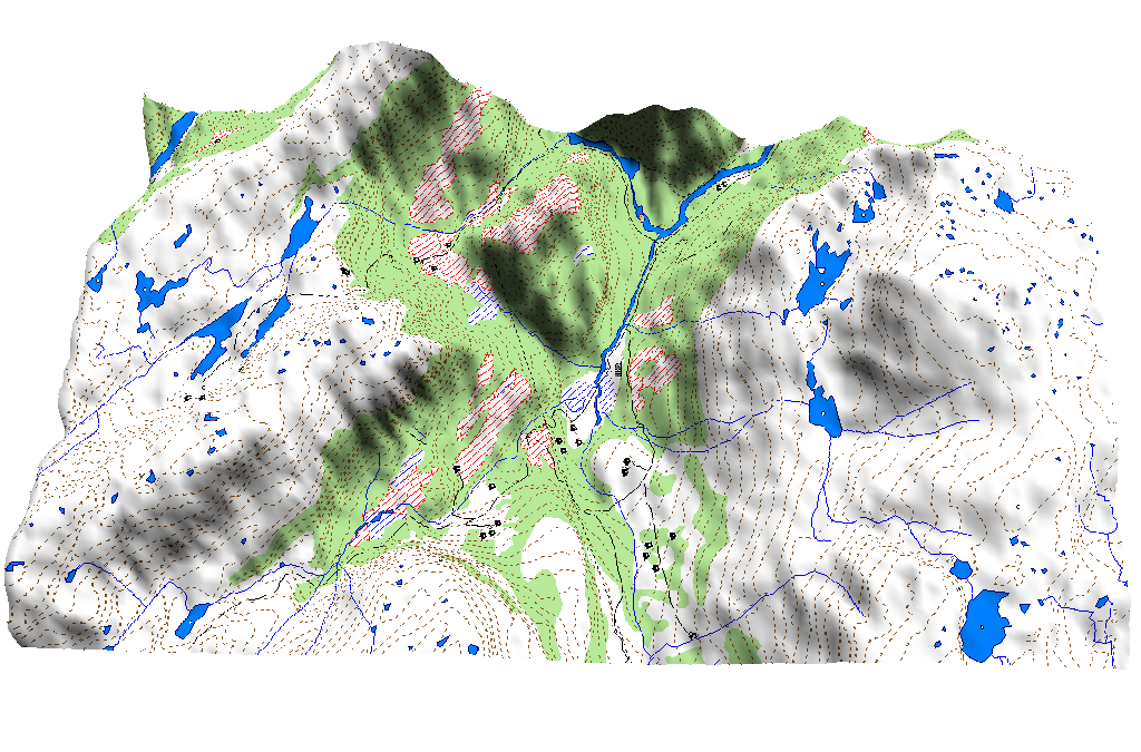
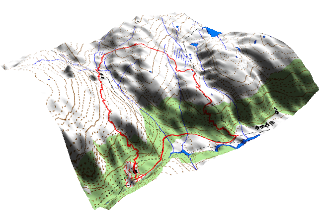
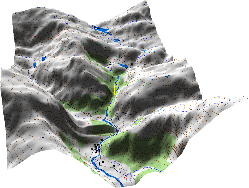
| 3D map showing Trefall (seen in the same direction as the bacground picture): | |||
| [more 3D maps] | |||
|
|||
|
|
|||
|
Other content on these pages
(click on a picture):
|
|||
| The mountain pasture Trefallstolen |

|

|
Other mountain pastures in Eksingedalen |
| Other places and hikes in Eksingedalen |

|

|
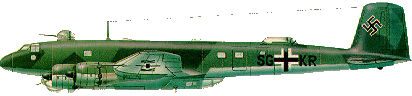
The plane on the mountain Kvitanosi |
| Emigration from Eksingedalen |

|

|
Guestbook |
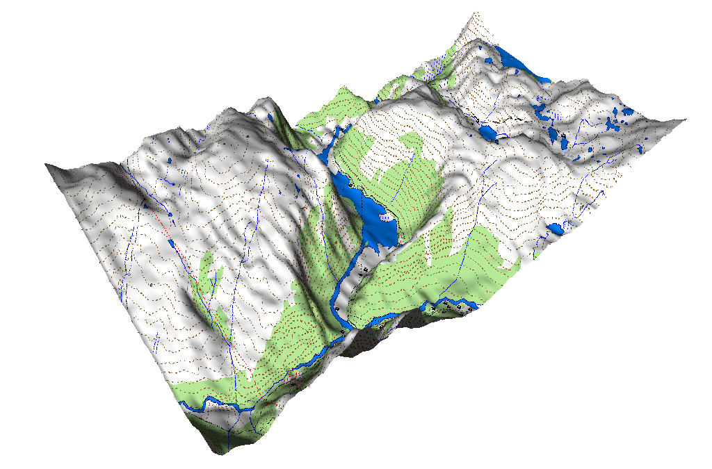
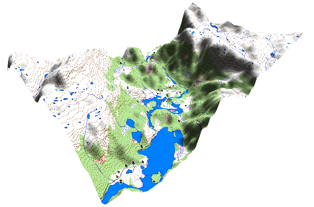
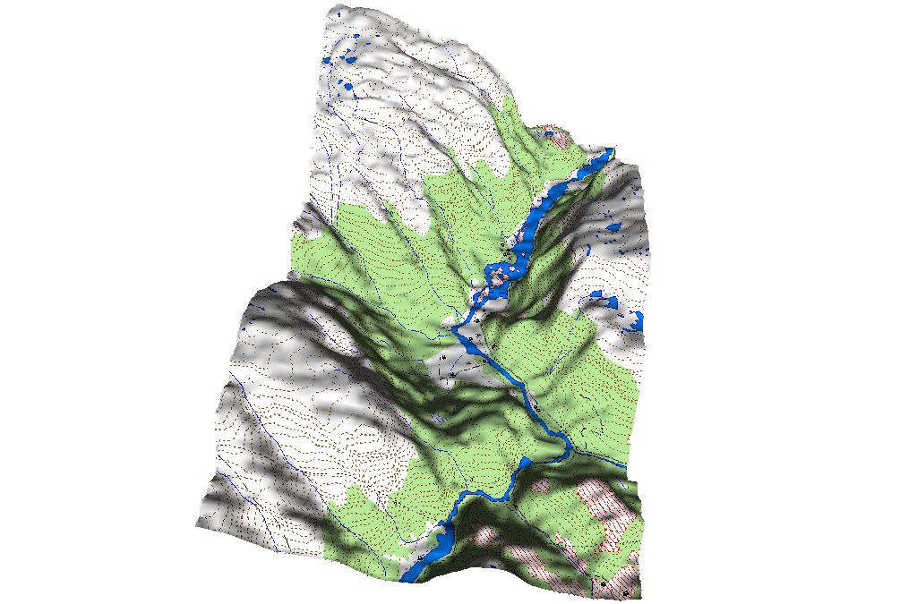
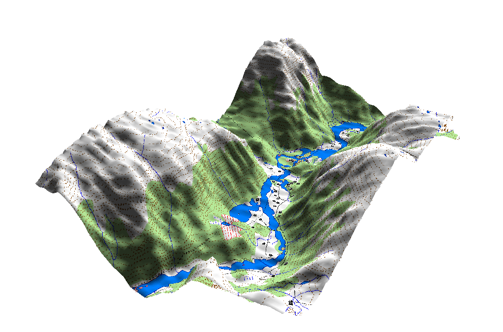
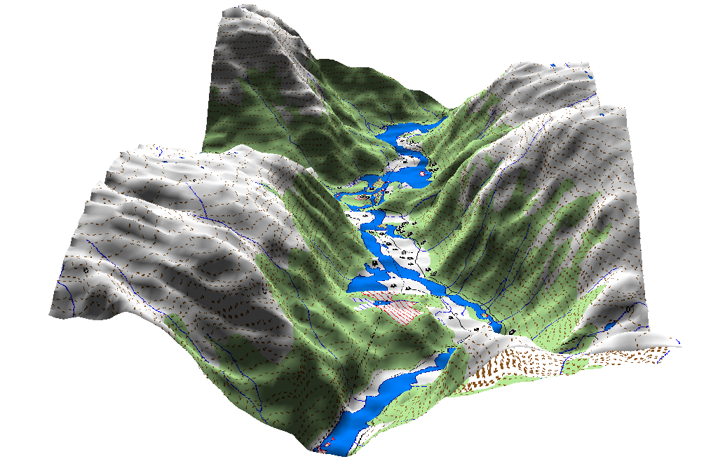
More Trefall 3D map (further down this page some Eksingedalen 3D maps):
(click the picture to make it bigger)
Copyright © kaare@trefall.com 2004-2009
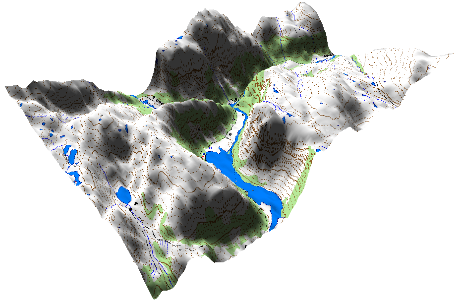
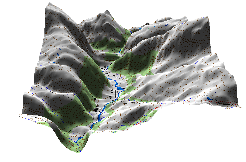
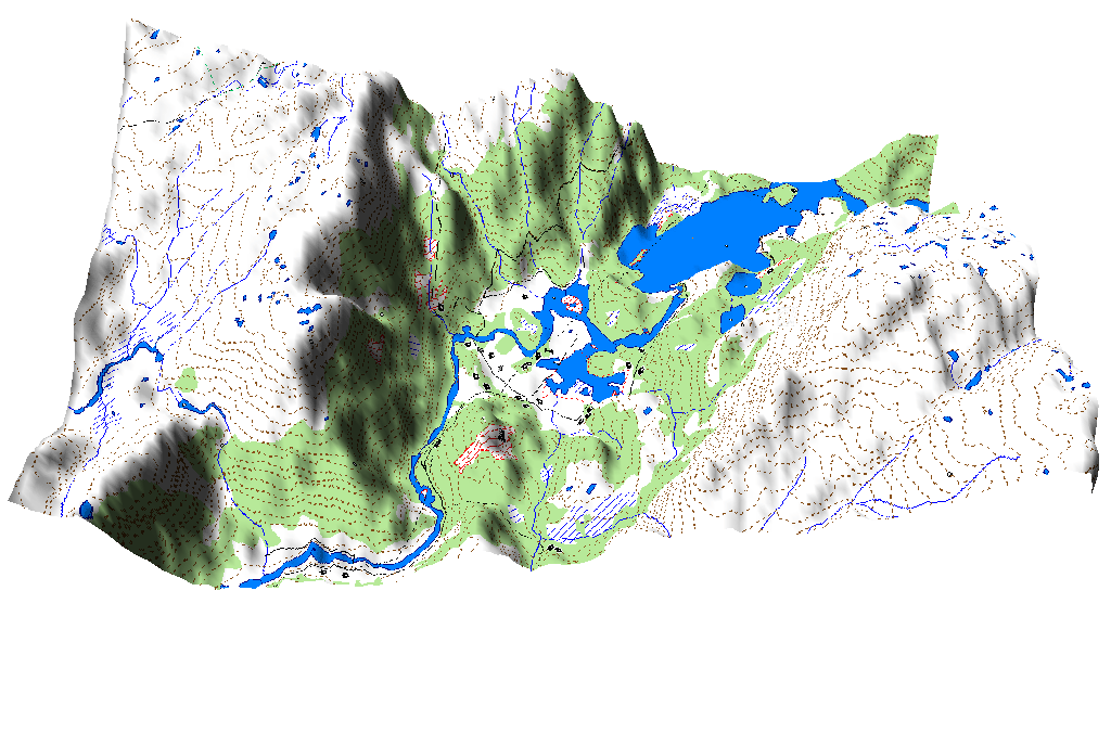
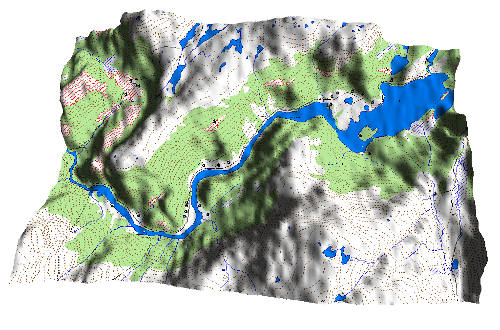
Some Eksingedalen 3D maps:
My Father's stories
About the life at Trefall
Written from stories by Haakon Trefall
Written by Kaare Trefall
|
|
[Althoug my father now has passed away I will here try to add some stories from my father's childhood at the farm Trefall.] | |
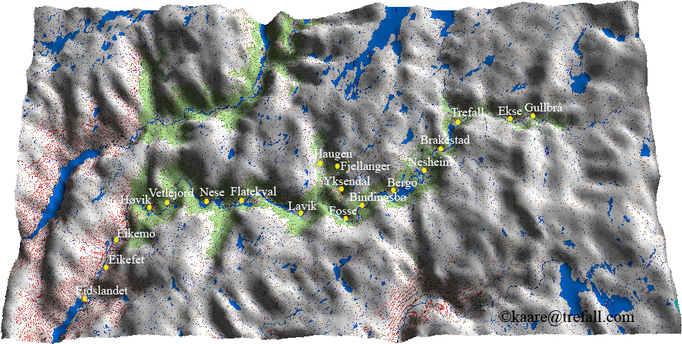
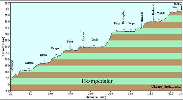
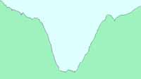
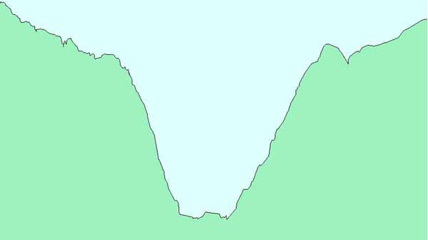
Map and elevation profile of Eksingedalen
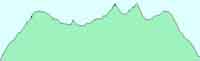
Elevation profile:
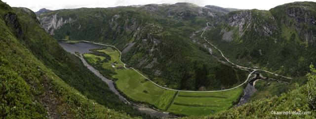
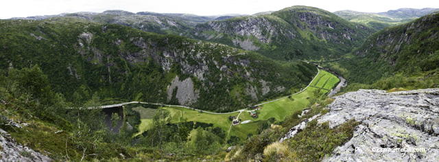
Panorama pictures from Trefall
|
|
|
|
|
|
|
|
|
|
DNT hiking map of Stoelsheimen
From DNT - the Norwegian Trekking Association pages
The Trefall Weather
|
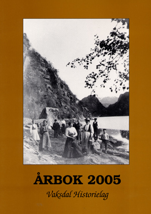
Innhald:
Utgjevar/Utformar: Vaksdal Historielag, Postboks 205, 5721 Dalekvam |
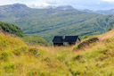
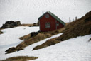
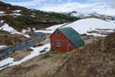
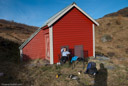
Trefallstoelen
| My Trefallstoel: Looking forward to the Saturday after work, to walk up the steep hillside Fribakkane together with my father, mother and brothers, up to the mountain pasture wher may grandma was staying, milking the cows and making butter from the milk. She often went down to the valley in daytime to participate in the hey colleting. But not on Saturdays. Today also my grandpa went up to "stoelen". And later to fall asleep to the sound of the river, Storagroi, passing the little house up in the mountains. And to wake up in the morning to the sound of the cow bells, and the sound of milk being milked in a pail. And the cows scratching theyer backs into the wall outside. And later the humming of the separator, with the continus "pling" telling about rigth turning speed. And out playing in the small waterfall in the other river, Veslegroi. Build a dam. And get the small water wheel to turn. Or go into the valley of Kvanndalen together with my father, to fish there. He, walking around on the shores of Nestavatnet with an otter. And the nice week before the school starts in the fall, all whole week at "stoelen" with the family. With the big late-summer moon just above the horizon. I already missed all this on the way down Fribakkane the last time this year. Soon the cows would be brought after, to the autumn pasture at Nordalen. |
| These, and other good memories from passed times when the work on the pasture was done the old way, have made "stoelen" a very special and dear place for me all years after. Memories from a time people still could make a good living in these rural districts of Norway. To be "really home", each time I am visiting Trefall I have to take a hike to "stoelen". |
| More stories and facts about the life and work at the mountain pasture, and more picture from current and past, will come. |
|
|
|||
|
Pictures from the mountain pasture
Trefallstoelen (click on a picture):
(here all with hike description, here these in printable version, more to come) |
|||
| My grandmother from about late 1950s or early 1960s |

|

|
Beautiful winter 27.02 and 01.03.2003 |
| Still spring 14.06.2003 |

|

|
Autumn and snow 01.11.2003 |
| The first hike this year (Easter) 05.04.2004 |

|

|
Easter, snow and sun 08.04.2004 |
|
Via Skarahammaren at 26.06.2004
With trip data |

|

|
Up Fribakkane in rain 18.09.2004 |
| Autumn an the first snow 13.11.2004 |

|

|
New:
Winter at the pasture 20.02.2005. With trip data |
| Easter on the pasture 21.03.2005 |

|

|
The summer 2005 |
| Not much snow at the pasture this winter, 25.03.2006 |

|

|
Easter 2006 |
| Spring on the pasture 17.06.2006 |

|
|
Summer 2006, the pasture and the path to it |
| Autumn on the pasture 23.09.2006 |
|
|
Spring 2007 |
| Summer 2007, 12th of July. |
|
|
Autumn 2007 |
| Easter 2008, 24th of March. |
|
|
Spring 2008, June 14th |
| Febryary 2010 |
|
|
October 2010 |
|
|
|
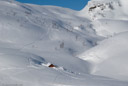
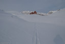
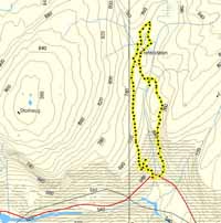
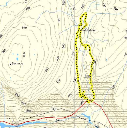
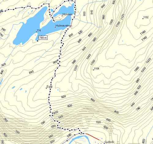
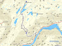
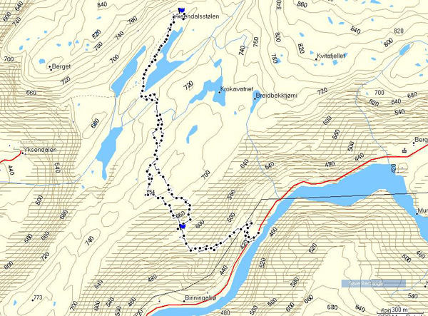
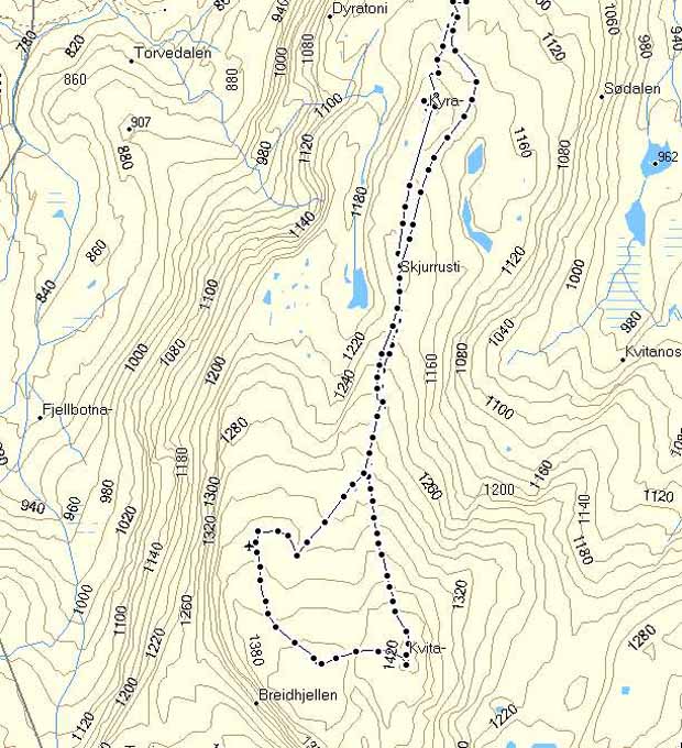
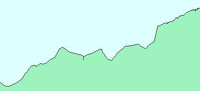
Skiing to Trefallstoelen 20th of February 2005.
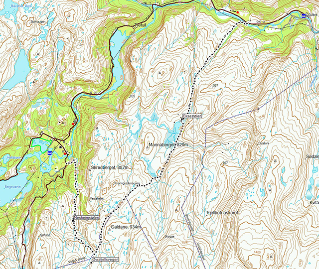
Click at the picture / title above to see pictures from the hike. Up Kyratoni, which is the east path on the map. Down again Fribakkane. Click on the map at right to see a bigger version, plus data and a bigger version of the hight profile. Deep snow and difficult to ski. A more detaile description so far only in Norwegian. |
|
|
|
Skiing to Trefallstoelen, up Kyratoni (the east path on the map), down again Fribakkane.
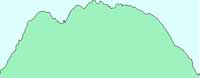
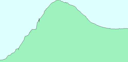
Hight profile for the hike. Starting at 547 meters above sea level. Higest point at 754 meters.

|
||
|
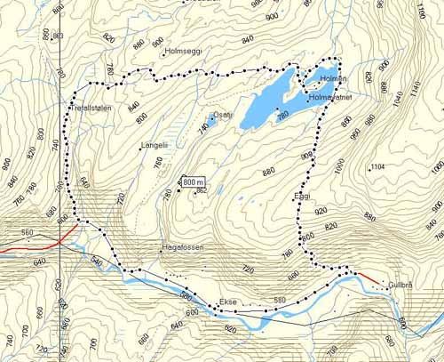
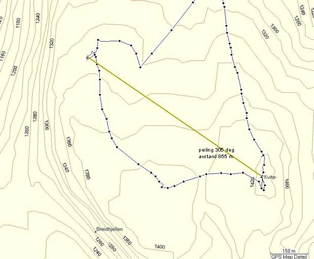
To Trefallstoelen via Skarahammaren 26th of June 2004.
Click at the picture / title above to see pictures from the hike. Up Skarahammaren, which is the west path on the map. More description coming soon! Click on the map at right to see a bigger version, plus data and a bigger version of the hight profile. |

|
|
| More description are coming soon. So far only in Norwegian. |
|
|
Start in Roeyrdalen (1), up to Skarahammaren (2), and to Trefallstoelen(3).
Home over Holmsegga (4), down to the Holmen path (5), and down to Hagaleitet (6)
(the numbers are shown on the map below and on the hight profile at the end on this pag).
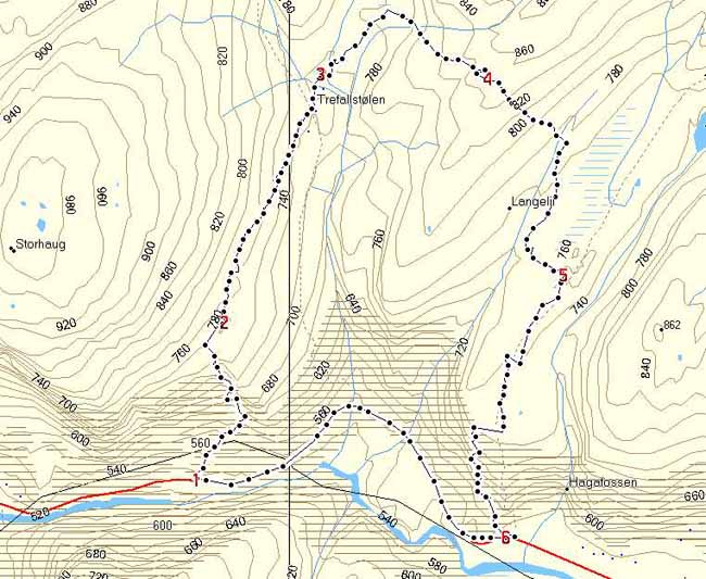
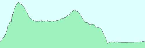
Hight profile for the hike. Starting at 539 meters above sea level. Higest point at 852 meters.
Other mountain pastures
|
From the farm Gullbraa in the east to the farm Eikefet in the west,
each farm has its own mountain pasture.
That would be 18 mounain pastures, or "stoels". Some fams in the valley of Eksingedalen have
more than one mountain pasture, as the farm Brakestad with Brakestadstoelen and Oevstestoelen.
In the uppermost area there are also mountain pastures belonging to Voss
side by side with "stoels" belonging to Eksingedalen, as for Eksetorvedalen.
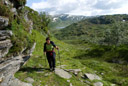
These "stoels" are small "pearls", both in nature and history. And so are also the paths from down in the valley up steep hillsides to the mouintain pastures. Many hevy loads have been carried these paths. "The Aerea Plan for Eksingedalen 2003" had done a great job in making all these paths, also the forgotten ons, available for hikes again, and with information abouth each path to be found down in the valley where each path begins. Also an information leaflet for each "stoel" are made (in norwegian), and could be found in the foodshop at Lavik. So fare only pictures and hike descriptions for some of these maountain pastures in the upper part of the valley could be found on this page. More to come, and also more information about each "stoel". My mouintain pasture Trefallstoelen, has its own page. |
|
|
|||
|
Pictures from other mountain pastures in the valley
(click on a picture):
(here all with hike description, here these in printable version, more to come) |
|||
|
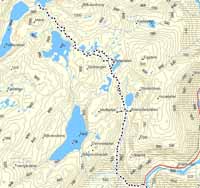
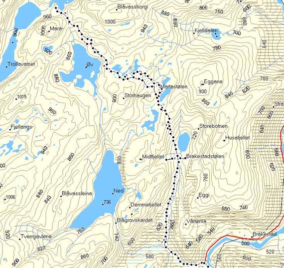
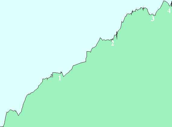
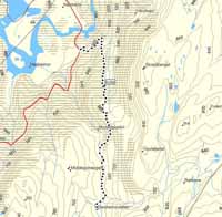
The Nesheimstoel 27.06.2004
(with trip data) |

|

|
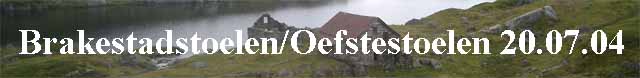
The Brakestadstoel and
The Oevstestoel 20.07.2004
(with trip data) |
|
Gullbraaholmen 23.07.2004
(with trip data) |

|
|
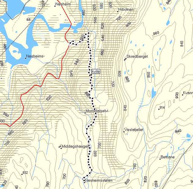
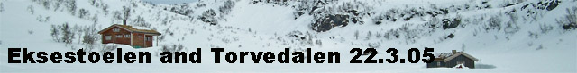
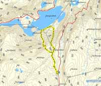
The Eksestoel and Torvedalen 22.03.2005
(with trip data) |
|
The Bergostoel 09.08.2005
(with trip data) |

|

|
The Bindingboestoel and
The Yksendalstoel 16.08.2005
(with trip data) |
| The Flatekvalstoel 27.07.2006 |

|

|
The Fossestoel 10.08.2006 |
| The Nesestoel 14.08.2006 |

|
||
|
||
|
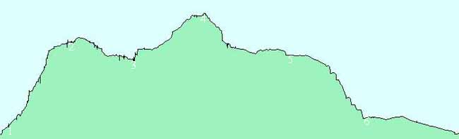
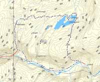
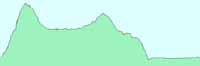
To Gullbraaholmen, and from there over Holmsegga to Trefallstoelen.
Click at the picture / title above to see pictures from the hike. Click on the map at right to see a bigger version, plus data and a bigger version of the hight profile. |
|
|
| More description are coming soon. So far only in Norwegian. |
|
|
From Gullbraa to Holmen:
The hike:
Hight profile for the hike. Starting at 574 meters above sea level. Higest point at 948 meters,
down to Holmen at 770.
Over Holmsegga at 880 meters to Trefallstolen at 733. Down Fribakkane to the main road at 560 meters.
Most of the hike in a bigger version.
Hight profile from the start at Gullbraa to back in the valley in Fribakkane:
|
||
|
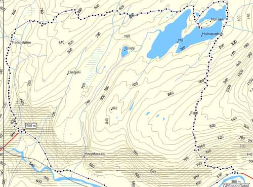
To Brakestadstoelen, so to Oevstestoelen.
Then passing Blaavatnet and into the Trodladalen.
Return the same path.
Click at the picture / title above to see pictures from the hike. Click on the map at right to see a bigger version and hight profile. |
|
|
| More description are coming soon. So far only in Norwegian. |

|
|
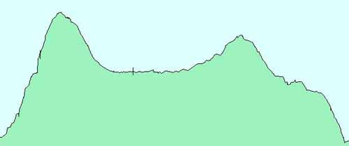
To Brakestadstoelen, than Oevstestoelen.
So passinf the upper Blaavatnet and into Trodladalen.
Hight profile for the hike. Starting at 490 meters above sea level.
Brakestadstoelen at 674 meters. Oevstestoelen at 785. 917 meters at Trodlavatnet.
|
||
|
To Nesheimstølen. The same path back again.
Click at the picture / title above to see pictures from the hike. Click on the map at right to see a bigger version and hight profile data. |
|
|
| More description are coming soon. So far only in Norwegian. |

|
|
To Nesheimstoelen.
Hight profile for the hike. Starting at 455 meters above sea level.
Highest point at 678 meters, Nesheimstølen 665 meters.
|
||
|
From Ekse to Eksestoelen, than to Torvedalen.
Click at the picture / title above to see pictures from the hike. Click on the map at right to see a bigger version and hight profile data. |
|
|
| More description are coming soon. So far only in Norwegian. |
|
|
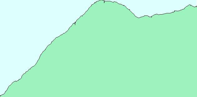
From Ekse to Eksestoelen, and than to Torvedalen, in the winter.
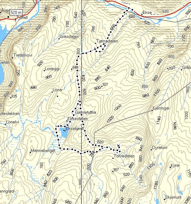
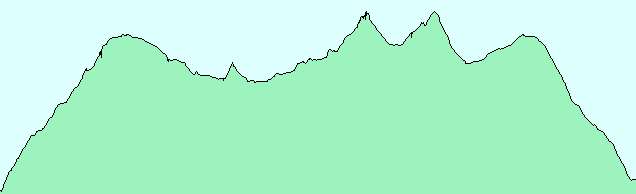
Hight profile for the hike.
|
|
||
|
From Indretjoedna to Bergostoelen, then down Skreiingsbrekko to Bergovatnet,
up again Brattefonnskaret to Bergostoelen and Indretjødna.
Click at the picture / title above to see pictures from the hike. Click on the map at right to see a bigger version and hight profile data. |
|
|
| More description are coming soon. So far only in Norwegian. |
|
|
From Indretjoedna to Bergostoelen and down Skreiingsbrekko to Bergovatnet, up again Brattefonnskaret.

Hight profile for the hike.
|
|
||
|
To Bindingboestoelen, than to Yksendalstølen. The same way back.
Click at the picture / title above to see pictures from the hike. Click on the map at right to see a bigger version and hight profile data. |
|
|
| More description are coming soon. So far only in Norwegian. |

|
|
To Bindingboestoelen, than to Yksendalstoelen, the same way back.
Hight profile for the hike.
Other places and hikes
|
|
|
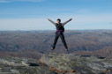
| The mountain of Kvitanosi is not the only place in Eksingedalen, althoug most of the hiks and picture on this page so fare are fom that place. There are a lot of other beautiful places, hikes and bike rides to be done in the valley and its surroundings. Descriptions and pictures will be added for some of these. | |
|
|
|||
|
Pictures from other places and hikes in the valley of Eksingedalen
(click on a picture):
(here all with hike description, here these in printable version, more to come) |
|||
| Biking Nordalen up to Holskard 1100 meters above sea level 18.07.2004 |
|

|
Kvitanosi from Gullbraa, via Kjaeringanosi, "The Plane", and home Soedalen, 21.07.2004 |
|
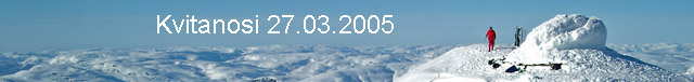
To Kvitanosi from Gullbraa at Easter 27.03.2005
With trip data |

|
|
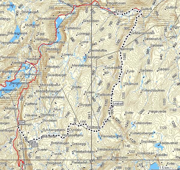
The wreck at Kvitanosi 31.08.2005 |
|
Vinningsleite, Kristnipa, Kvitanosi, Gullbraa 13.08.2005
With trip data |

|

|
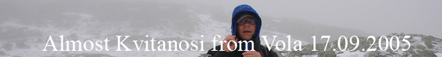
Almost Kvitanosi from Vola at 17.09.2005
With trip data |
|
Kvitanosi via Eksestorvedalen og Dyratoni 17.08.2006
Trip data coming soon |

|
|
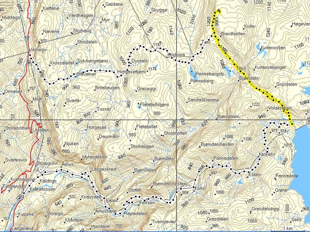
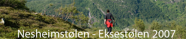
Nesheimstølen - Eksestølen 13. juli 2007
With trip data |
|
Kvitanosi 9th of October 2010
|
|
|
Kvitanosi 6th of September 2012
Start from Vaala. |
|
|
|||
| About "The Plane" on the mountain Kvitanosi | |||

|
|||
|
||
|
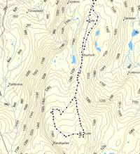
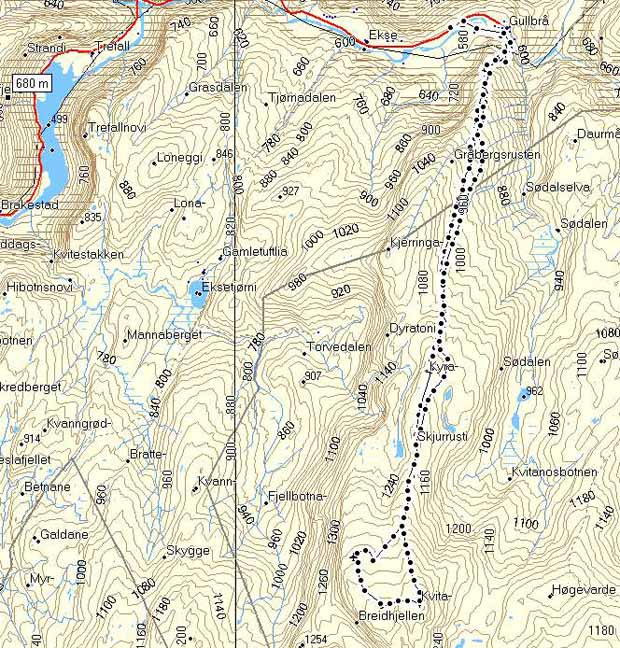
From Gullbraa to Kvitanosi.
Click at the picture / title above to see pictures from the hike. Click on the map at right to see a bigger version and hight profile data. |
|
|
| More description are coming soon. So fare only in Norwegian. |
|
|
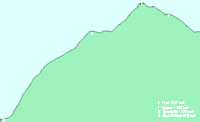
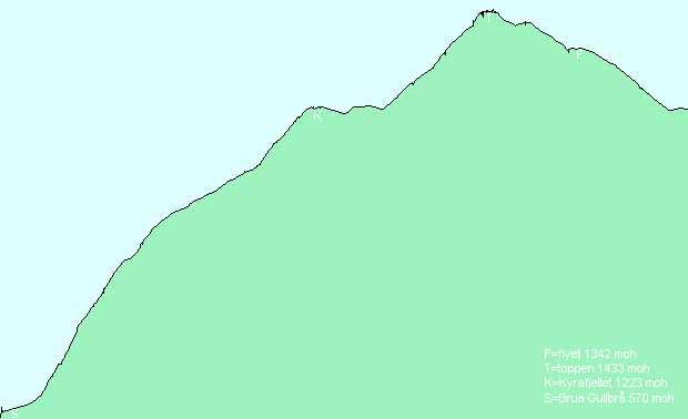
To Kvitanosi from Gullbraa in the winter.
Hight profile for the hike from the bridge at Gullbraa, to the top at 1433 meters, to "the plane", and down again to the same route as up.
|
|
||
|
Vinningsleite, Kristnipa, Kvitenosi, Gullbraa 13.08.2005.
Click at the picture / title above to see pictures from the hike. Click on the map at right to see a bigger version and hight profile data. |

|
|
| More description are coming soon. So fare only in Norwegian. |
|
|
Vinningsleite, Kristnipa, Kvitenosi, Gullbraa.
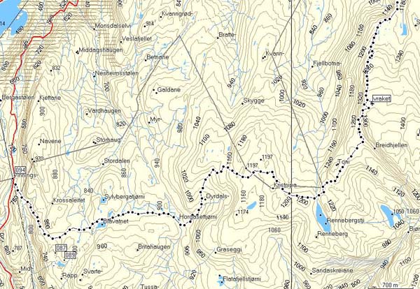
Hight profile for the hike

|
||
|
Volakroken to Kvitanosi 17.09.2005.
Click at the picture / title above to see pictures from the hike. Click on the map at right to see a bigger version and hight profile data. |
|
|
| More description are coming soon. So fare only in Norwegian. |
|
|
Trying to reach Kvitanosi from Vola.
The hike as it whent:
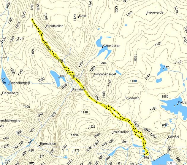
The intention, stopped by a blizzard:

A map also showingg a hike from Nesheimsfjwllet, and the road from Brekkhus/AArhus to Vola:
Hight profile for the hike from Vola to the vreck.

|
||
|
Click at the picture / title above to see pictures from the hike.
Click on the map to the right to se the route.
More description are coming soon. So fare only in Norwegian. |
|
|
The hike is shown on the map.
www.trefall.com/wap/
So far only in norwegian.
| Kongsberg 6/2 2005. |
|
Some background on these pages.
The intentions with these pages are to present a very nice place on earth: the valley of Eksingedalen on the west coast of Norway, where I grew up at the farm Trefall. In addition to pictures, description of hikes, som local history, about old names, and other stuff will be added. An example of local history is the page about the wreck of the German aeroplane on Kvitanosi. More material will be added in the coming months. |
| --k@@re |
| (The fist "abut" information only exists in norwegian version.) |
| --k@@re |
Links
|
Mountains, nature, environment:
|
|
|
|
|
| Eksingedalen.no | The official Eksingedalen page. |
|
|
|
| The Emerald Ribbon | A page about Eksingedalen and its sourroundings. |
|
|
|
| Westcoastpeaks.com | Do a "net hike" on these pages! Start on Kvitanosi. A lot of beautiful panorama and air photos! |
|
|
|
| Vikjavev.no | Beautiful photos from the mountain pastures in tne inner parts of Stoelsheimen, + from Arnafjord/Vik in Sogn. See the live panorama photos (select photo in the menu to the left), and the map functionality (see the "Map" button in the menu to the left on the main page. Resize the window (pull right buttom corner) and right click on the empty background and select "Refresh") |
|
|
|
| VossNow | Beautifil photos by Svein Ulvund, with Voss as basis, but also with photos from the Eksingedalen area. |
|
|
|
|
Genealogy, history, America: |
|
| Digitalarkivet | Church registers, censuses, etc, etc. |
|
|
|
| Nordmændene_i_Amerika | A book in norwegian about Norwegian imegration to America - by Marin Ulvestad, 1907. |
|
Links you want to see on this page? Send them to mee! |
|
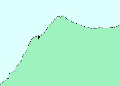
Sett austover, Gullbr� i forgrunnen.
Gul M = Mortensfossen (muligens �rlite lenger nede i elva).
Daf�ret g�r her vidare inn til Holo, s� Torvedalen. Bakgrunnsbilete er foto i same retning.
Welcome to k@@re's Homepage
Coming soon!
e-mail: kaare@trefall.com (pgp key)
| New: (newest first) |
(see also the "twitter-messages" window on the front-page)
|
Copyright © kaare@trefall.com 2004-2023
(pgp)
Last updated 17th of April 2023